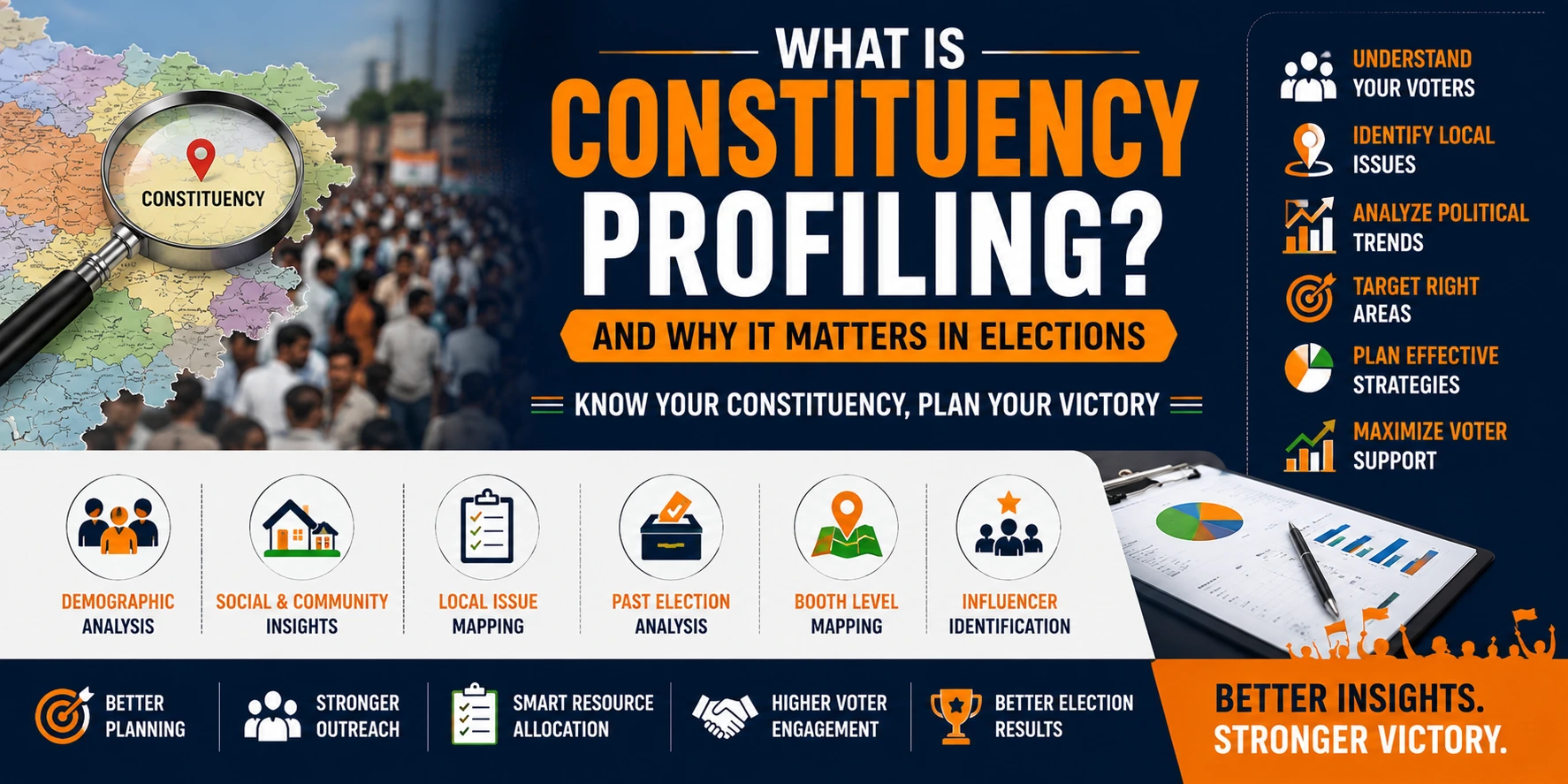
Constituency profiling is the structured process of collecting, organizing, verifying and analyzing information about an electoral constituency. It brings together electoral history, geography, polling-booth information, local issues, public infrastructure, field observations, political developments and other relevant constituency-level information into one organized research framework. The purpose of constituency profiling is to help political parties, candidates, leaders and campaign teams understand the constituency beyond broad assumptions and make more informed decisions about research, organization, field operations, resource planning and campaign management.
What is Constituency Profiling?
Constituency profiling is a systematic study of the political, geographical, electoral, administrative and ground-level characteristics of a specific electoral constituency.
A constituency profile can combine information from public election records, historical results, booth lists, maps, field surveys, constituency visits, local issue research and structured field reporting.
Instead of relying on disconnected pieces of information, constituency profiling organizes these inputs into a consolidated research framework. This can help campaign teams understand how the constituency is structured, what important issues exist in different areas and what additional information may be required before operational decisions are made.
Why Constituency Profiling Matters in Elections
No two constituencies are exactly alike. Constituencies can differ in geographical size, settlement patterns, infrastructure, public issues, political history, turnout patterns, administrative divisions and field conditions.
A campaign strategy developed without understanding these differences may overlook important ground realities. Constituency profiling provides a structured information base that can support campaign planning, organizational deployment, surveys, booth management and monitoring.
- Creates a structured understanding of constituency geography
- Organizes historical electoral information
- Identifies important local and development issues
- Supports booth-level research and operational planning
- Improves coordination between research and field teams
- Provides a base for constituency-wide reporting
- Helps identify information gaps requiring further research
- Supports more informed campaign-resource planning
A constituency profile should not be treated as a static collection of election statistics. The most useful profile combines historical data, geographical understanding, field research, local issue mapping and continuous reporting so that campaign teams can understand both long-term patterns and changing ground conditions.
Core Objectives of Constituency Profiling
Constituency profiling is not simply a data-collection exercise. Its purpose is to convert dispersed constituency information into a structured knowledge base that can support election research and operations.
- Understand the physical and administrative structure of the constituency
- Organize historical election and polling-booth information
- Identify major local issues and public-service concerns
- Understand how different areas of the constituency differ
- Create a base for political surveys and field research
- Support booth-management planning and reporting
- Help campaign teams coordinate field operations systematically
- Maintain an updated constituency intelligence repository
Key Components of Constituency Profiling
A comprehensive constituency profile may include several layers of information. The exact depth depends on the type of election, available data and campaign requirements.
Geographic Profile
Maps villages, wards, colonies, urban areas, rural areas, administrative boundaries and polling locations.
Electoral History
Organizes past election results, turnout information, margins, vote-share trends and other historical electoral records.
Booth-Level Profile
Structures polling-booth information, historical turnout and relevant booth-wise electoral data.
Local Issue Profile
Documents constituency concerns relating to infrastructure, services, employment, agriculture, development and other local matters.
Political Environment
Reviews historical political competition, major campaign developments and relevant constituency-level political activity.
Public Infrastructure
Reviews important local infrastructure such as roads, transport, healthcare, education and civic-service availability.
Stakeholder Mapping
Identifies relevant public institutions, associations, community organizations and local civic stakeholders.
Field Intelligence
Consolidates verified field observations, survey findings and reports from constituency teams.
Reporting & Monitoring
Maintains structured constituency reports, updates and dashboards for campaign and research teams.
Step-by-Step Constituency Profiling Process
A professional constituency profile is usually developed through a sequence of research, mapping, verification and analysis stages.
Role of Geographic Mapping in Constituency Profiling
Geography affects the way an election campaign is researched and organized. A constituency may include dense urban neighbourhoods, semi-urban settlements, villages, remote areas or a combination of these.
Geographic mapping helps campaign teams understand how polling booths, villages, wards, roads, transport routes and major local institutions are distributed across the constituency.
- Village and ward mapping
- Urban, semi-urban and rural area classification
- Polling-station and booth-location mapping
- Major transport and connectivity routes
- Administrative boundaries and local governance units
- Identification of logistical and accessibility considerations
Booth-Level Constituency Profiling
Polling booths provide one of the most practical units for organizing constituency-level election information. Booth-level profiling can connect polling-station details with historical turnout, past election results, geographic location and field reporting.
This creates a more detailed picture than constituency-wide statistics alone and can support Booth Management , field coordination and campaign monitoring.
- Polling-booth identification and mapping
- Historical booth-wise result organization
- Past turnout comparison
- Geographic linkage between booths and localities
- Field observations connected with booth areas
- Structured booth-level reporting
Constituency Profiling vs Booth Analysis
Constituency profiling and booth analysis are related but different. Constituency profiling provides a broad understanding of the entire electoral constituency, while booth analysis examines polling areas at a more granular level.
Constituency Profiling
Covers constituency geography, election history, local issues, public infrastructure, political environment, field research and overall operational conditions.
Booth Analysis
Focuses more specifically on polling-booth information, historical booth-wise election patterns, turnout and booth-level operational data.
Used together, constituency profiling provides the wider context while booth analysis provides detailed local-level information.
Local Issue Mapping
Local issues are an important component of constituency research because different parts of the same constituency may face very different development or service-related concerns.
Field surveys, constituency visits, public information and structured reporting can help identify recurring issues and understand where they are concentrated.
- Roads and local connectivity
- Water supply and sanitation
- Healthcare infrastructure
- Schools and educational facilities
- Employment and livelihood concerns
- Agriculture and rural infrastructure
- Transport and mobility
- Urban civic-service issues
Issue mapping should be based on verified ground information rather than isolated assumptions. It can complement political survey research and constituency field studies.
Political Trend and Past Election Result Analysis
Historical election results provide an important reference point for understanding a constituency. They can show how turnout, vote share and election margins have changed across previous elections.
Historical data should not be treated as a prediction of future results. Political conditions, candidates, alliances, public issues and turnout can change significantly between elections.
- Past constituency election results
- Party-wise vote-share trends
- Previous winning and losing margins
- Historical turnout patterns
- Booth-wise election-result comparisons
- Changes across successive election cycles
Historical analysis becomes more useful when combined with current field research, surveys and updated constituency information.
Public Infrastructure and Development Mapping
Constituency research can also include a structured review of important public infrastructure and service availability.
This helps researchers understand local development conditions and gives field teams a factual base for documenting public concerns.
- Road and transportation networks
- Schools and educational facilities
- Hospitals and healthcare facilities
- Water, sanitation and drainage infrastructure
- Agricultural and irrigation facilities where relevant
- Major markets and economic activity centres
- Public-service offices and institutions
- Other significant development infrastructure
Role of Stakeholder Mapping
Constituencies contain many public, civic and organizational stakeholders. Understanding the institutional environment can help research teams obtain a more complete picture of local conditions.
Stakeholder mapping may include local government bodies, resident associations, trade organizations, professional bodies, civil-society organizations, social workers and other legitimate public or community institutions.
The purpose of stakeholder mapping is to understand the local organizational landscape and sources of constituency information—not to assume that any stakeholder represents the views of every person in an area.
Role of Field Research in Constituency Profiling
Public election data can explain important historical patterns, but it may not capture current ground conditions. Field research helps provide updated context.
Depending on the scope of work, field research may include structured surveys, area visits, issue documentation, observational studies and reports from trained field teams.
Information collected from the field should be documented consistently and verified wherever possible before it becomes part of a constituency report.
- Structured political or public-opinion surveys
- Area and locality visits
- Local issue verification
- Observation of public infrastructure
- Field-team reporting
- Continuous ground-information updates
Data Accuracy, Verification and Source Quality
The usefulness of a constituency profile depends heavily on the quality of the information used to create it. Inaccurate, outdated or poorly sourced information can lead to incorrect conclusions.
A professional profiling process should record important sources, distinguish verified information from field observations and regularly update information that may change during an election cycle.
- Use reliable and appropriately sourced electoral records
- Record the date and source of important datasets
- Verify significant field claims where possible
- Separate factual records from interpretation
- Update outdated constituency information
- Maintain appropriate data-security and access controls
Constituency Reports, Dashboards and Monitoring
The final output of constituency profiling should be usable by campaign leadership and field teams. Large amounts of raw information are less valuable if decision-makers cannot review them efficiently.
Depending on the assignment, constituency intelligence can be presented through written reports, maps, booth summaries, issue trackers, dashboards and periodic field updates.
- Constituency overview report
- Geographic and polling-booth maps
- Historical electoral analysis
- Local issue summaries
- Field-research reports
- Booth-level information dashboards
- Operational update reports
- Research-gap and verification logs
Role of Technology in Constituency Profiling
Technology can help manage large volumes of geographic, electoral and field information associated with a constituency.
Digital tools can support data organization, field-data collection, mapping, reporting and centralized access for authorized campaign or research teams.
- Digital constituency databases
- Booth and locality mapping systems
- Mobile field-data collection
- Survey-data management
- Dashboard-based reporting
- Issue and activity tracking
- Data validation workflows
- Centralized information access
Technology should support research quality and operational discipline; it cannot substitute for verified data and reliable field work.
Constituency Profiling and Political Surveys
Constituency profiling and political surveys complement each other. Profiling provides the broader geographic, historical and operational context, while surveys provide structured information about current public opinion or issue awareness within the scope of the research.
A constituency profile can help survey teams understand the geography, booth structure and local issues before fieldwork begins. Survey findings can then update or expand the broader constituency profile.
When both methods are used carefully, researchers can combine historical information with current ground observations rather than relying on either source alone.
How Constituency Profiling Supports Campaign Strategy
Constituency profiling provides an information base for campaign management. It does not by itself determine campaign strategy, but it gives campaign leadership a structured picture of the constituency before operational priorities are established.
Constituency intelligence may support decisions related to field-team organization, research priorities, event logistics, booth management, public-issue monitoring and resource allocation.
- Supports constituency-level operational planning
- Provides context for booth-management structures
- Helps prioritize additional research requirements
- Improves logistical planning across geographic areas
- Supports issue-based public information preparation
- Provides a framework for continuous campaign monitoring
Benefits of Professional Constituency Profiling
The main advantage of constituency profiling is that it converts fragmented information into an organized research and operational framework.
- Clearer understanding of constituency geography
- Better organization of historical electoral information
- More systematic local issue documentation
- Improved booth-level research framework
- Better coordination between research and field operations
- More reliable constituency reporting
- Improved visibility into information gaps
- Stronger basis for campaign planning and monitoring
Common Challenges in Constituency Profiling
Constituency profiling can involve large datasets, complex geography and rapidly changing field information. Maintaining consistency and accuracy can therefore be challenging.
- Incomplete or outdated electoral information
- Changes in polling-booth or administrative boundaries
- Difficulty verifying some field reports
- Differences between official data and local observations
- Large geographic areas and logistical constraints
- Inconsistent reporting by field teams
- Duplicate or conflicting information
- Need for regular profile updates during the campaign
Best Practices for Constituency Profiling
A useful constituency profile should be structured, transparent and easy to update.
- Define the research scope before collecting data
- Use reliable public and official information where available
- Map constituency geography systematically
- Organize information at constituency, area and booth levels
- Combine historical data with current field research
- Verify important field claims wherever practical
- Record data sources and update dates
- Use standardized reporting formats
- Maintain appropriate confidentiality and data security
- Update the constituency profile as new information emerges
How Professional Constituency Profiling Services Help
Creating a reliable constituency profile can require research teams, field investigators, electoral-data analysts, geographic mapping, reporting systems and campaign-domain knowledge.
Professional election-research organizations can help integrate these functions into one structured process and maintain consistent standards for data collection, verification and reporting.
Depending on the assignment, constituency profiling can be integrated with Political Survey , Voter Data Analysis, Booth Management, Election Campaign Management and broader election intelligence requirements.
Megamind's Approach to Constituency Profiling
Megamind approaches constituency profiling as an integrated Research + Data + Ground Intelligence + Technology process.
The process begins with understanding the election, constituency geography and research requirement. Relevant historical electoral data, booth information, maps, local issues and available public information can then be organized into a structured constituency database.
Depending on the assignment, this can be complemented by political surveys, ground research, field verification, booth-level reporting and technology-enabled dashboards.
The objective is to provide political parties, candidates, leaders, prospective candidates and campaign teams with a reliable constituency intelligence framework that supports research, planning, coordination and monitoring.
Explore Megamind Political Research & Survey Services →Constituency Profiling Across India
Constituency profiling can be used for Lok Sabha, Vidhan Sabha, municipal, panchayat and other electoral contexts across India.
The research design may vary significantly because constituencies differ in geographical size, settlement pattern, administrative structure, infrastructure and available data.
A metropolitan constituency may require detailed ward and colony mapping, while a rural constituency may require village, road-network and accessibility mapping across a much larger geographic area.
For this reason, constituency profiling should be customized to the actual election geography and research requirement rather than applying one fixed template everywhere.
FAQs About Constituency Profiling
What is constituency profiling?
Constituency profiling is the structured process of collecting, organizing and analyzing geographic, electoral, local-issue and field information about an electoral constituency.
Why is constituency profiling important?
It provides campaign and research teams with an organized understanding of constituency geography, election history, polling booths, local issues and current ground conditions.
What information is included in a constituency profile?
Depending on the assignment, a profile may include maps, electoral history, booth information, turnout data, local issues, infrastructure, field observations and structured research reports.
What is booth-level constituency profiling?
Booth-level profiling organizes polling-booth information, historical results, turnout, geography and relevant field reporting at a more detailed level within the constituency.
What is the difference between constituency profiling and booth analysis?
Constituency profiling covers the wider electoral constituency, while booth analysis focuses specifically on polling-booth-level electoral and operational information.
How are local issues identified?
Local issues can be identified through field surveys, constituency visits, public information, infrastructure review and structured reporting from trained field teams.
How are past election results used in constituency profiling?
Historical results can be used to study turnout, vote-share trends, margins and changes between election cycles. They should be treated as historical evidence rather than predictions of future results.
What role does technology play in constituency profiling?
Technology can support digital databases, mapping, field-data collection, survey management, dashboards and centralized reporting.
How often should a constituency profile be updated?
Stable information such as geography may need fewer updates, while field conditions, local issues and campaign-related developments may require periodic review during an election cycle.
Who can use constituency profiling services?
Political parties, candidates, leaders, prospective candidates, campaign teams and political organizations may use constituency profiling according to their research and operational needs.
Constituency Profiling as the Foundation of Election Intelligence
Constituency profiling provides a structured way to understand the geography, electoral history, polling-booth network, local issues, infrastructure and current field conditions of an electoral constituency.
Its value comes from connecting different types of information rather than depending on one source alone. Historical election data provides context, geographic mapping explains the physical structure, surveys provide current research inputs and field teams provide ground-level observations.
When these inputs are organized, verified and updated through a professional research framework, political parties, candidates and campaign teams can work with a more reliable understanding of the constituency.
For this reason, constituency profiling can serve as an important foundation for political surveys, electoral data analysis, booth management, campaign planning, field coordination and broader election-intelligence operations.